Soils Guide
Mancos Shale and expansive soil in the Grand Valley
The pale gray country around Grand Junction is not scenery, it is the reason foundations here behave the way they do. This is what the ground is made of, which soil series sit under the city, and what each of them does to concrete.
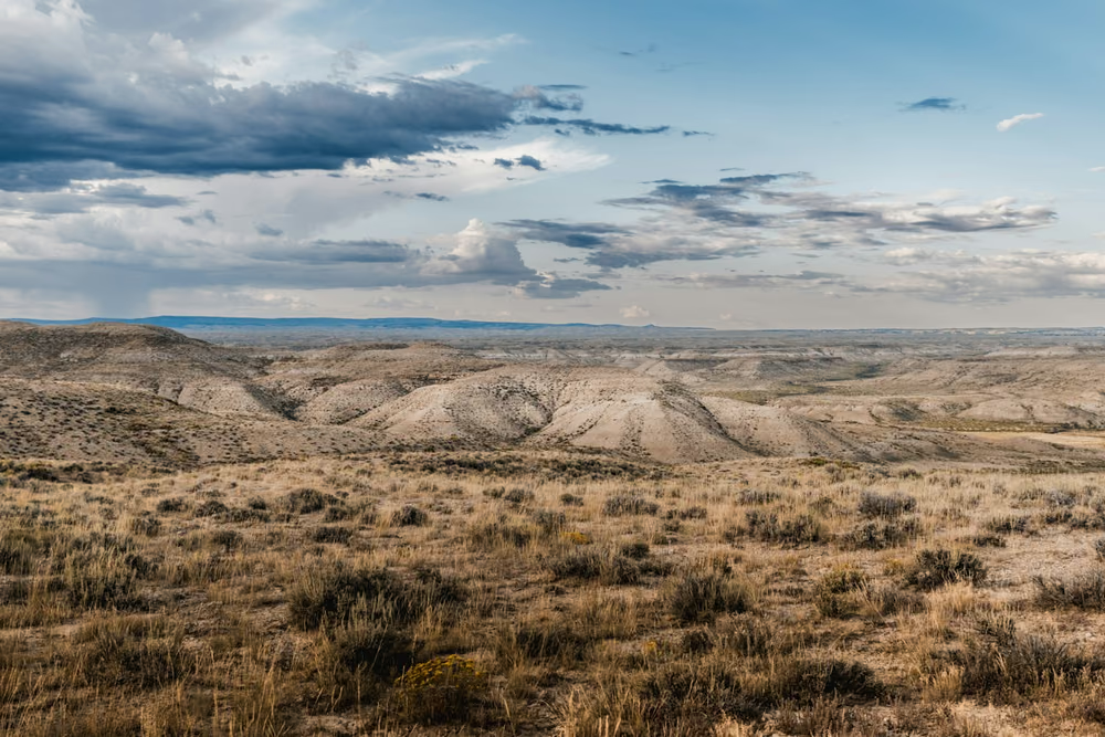
Mancos Shale is a Cretaceous marine shale, laid down when this part of Colorado was seabed. It underlies most of the Grand Valley, and where it is exposed it weathers into the pale gray, sparsely vegetated badlands you can see from I-70 and from almost any high point around the city. The US Geological Survey describes the irrigated ground of the Grand Valley as located on soils derived from Mancos Shale or from alluvium overlying Mancos Shale, and characterises the surficial material as shale-derived clays.
Why marine shale produces a difficult soil
The clay fraction weathering out of Mancos Shale is dominated by smectite, alongside illite and kaolinite. Smectite is the expansive clay family. Its crystal structure admits water molecules between the layers, so the mineral physically increases in volume when wetted and shrinks again when dried. The Colorado Geological Survey describes expansive soil and rock as the most significant geologic hazard in Colorado in terms of financial cost, notes that clays can expand up to 20 percent by volume when exposed to water, and puts the force they can exert at up to 30,000 pounds per square foot. It also advises that identifying the hazard on a specific site is work for a competent professional soil engineer and engineering geologist.
Thirty thousand pounds per square foot is more than enough to lift a house. It is why heave, not just settlement, is a live possibility on Grand Valley slabs.
The active zone, and why pier depth is a soil question
Only the upper part of the soil profile takes part in the cycle. Below a certain depth, moisture content is effectively constant year to year and the soil does not change volume. That upper, seasonally variable layer is the active zone, and everything a foundation problem does happens inside it.
The soil series mapped under Grand Junction
The Natural Resources Conservation Service maps soils by series and records a linear extensibility value for each, which converts into a standard shrink-swell class. Values below 3 are low, 3 to 6 moderate, and above 6 high. Under and around Grand Junction, the picture looks like this.
| Series | Linear extensibility | Shrink-swell | Notable |
|---|---|---|---|
| Deaver | 7.0 | High | Fine, smectitic, clay to 45 percent |
| Massadona | 6.8 | High | Fine, smectitic, high salinity |
| Biedsaw | 6.7 | High | Fine, smectitic |
| Chipeta | 5.3 | Moderate | Shallow, gypsic |
| Fruitvale | 4.8 | Moderate | Gypsum-accumulating, about 8 percent gypsum |
| Killpack | 4.7 | Moderate | About 10 percent gypsum, saline |
| Green River | 4.3 | Moderate | Seasonal wetness |
| Homko / Uffens | 4.2 / 4.0 | Moderate | Sodium-affected |
| Cojam | 4.0 | Moderate | Poorly drained, shallow water table |
| Fruita | 3.3 | Moderate | About 35 percent gypsum |
| Persayo, Blackston, Glenton, Sheppard | 0.6 to 2.6 | Low |
The honest reading of that table is that Grand Junction is not uniformly high-risk ground. It is highly variable ground, which is a different and in some ways more awkward problem, because it means general rules are unreliable and site-specific information is worth paying for.
Gypsum, and why concrete durability is a separate question
Several of the series above are gypsum-accumulating, classified taxonomically as Argigypsids or Gypsiargids. The Fruita series records around 35 percent gypsum. USGS separately notes abundant secondary gypsum occurring in shale partings and fractures in Mancos Shale residuum.
Gypsum is calcium sulfate. Sulfate in contact with concrete reacts with the cement paste, forming expansive products that crack and soften the concrete from within. It does not move the house; it degrades the foundation itself, and it shows up as spalling, softening and exposed rebar at a stem wall rather than as cracking from movement. Where sulfate exposure is known, sulfate-resistant cement is the standard mitigation, and on repair work that specification matters for footings, pier caps and any replacement stem wall going into the ground.
Salinity, sodium and selenium
The same soil data records high electrical conductivity in several series, and Homko and Uffens are sodium-affected soils classified as Natrargids. Sodic soils behave differently from ordinary clays: the sodium keeps clay particles dispersed rather than aggregated, which reduces permeability and changes how water moves through the profile.
Selenium is the wider environmental story. USGS identifies the western half of the Grand Valley as one of the primary selenium source areas in the region, with soils derived from seleniferous Mancos Shale, and estimates that irrigation drainage may account for a substantial share of the selenium load in the Colorado River near the state line. It is a water-quality issue rather than a foundation one, but it is the same shale doing it, and it is part of why the Bureau of Reclamation funds canal-lining work here under the Colorado River Basin Salinity Control Program.
What all of this means if you own a house here
- Moisture stability beats moisture level. A consistently damp foundation is safer than one that dries out in June and gets soaked in August.
- Your lot is not your neighbor's lot. Series boundaries run through neighborhoods. Two identical houses can have different ground.
- Concrete deterioration is a separate failure mode. A crumbling stem wall in gypsum-bearing soil is a chemistry problem, not a movement problem, and piering will not fix it.
- Pier depth cannot be quoted in advance. It is set by where the active zone ends, and that is discovered during installation.
Next: where the water in this soil comes from, and how to read the cracks it produces.